With drones becoming a key component in Commercial Real Estate Marketing, there is no better time to have an aerial assistant for your business than right now. Realtors have revealed that their selling success rate dramatically shot up to 68% with aerial photographs. If you're still relying on ground photos of your listed properties, here's all that you're leaving on the table:
Providing the prospective buyers dynamic visuals and accurate magnitude of the property including entry points, parking lot size, roof information, and everything around the property.
Highlighting the desired property features, and saving time and effort on multiple site visits.
Staying ahead of the competition.

More than any other sector, the construction sector has witnessed tremendous benefits from aerial data. Over the past few years, the use of drones in the construction industry has grown by 250%. This is no coincidence. Contractors are quickly transitioning. Drones can do what is not humanly impossible, or what is highly dangerous, in less than 1/10th of the time.
Drone services from our catalogue of expert pilots can assist your business with error-free site review, aerial surveys, instant communication, accurate mapping, 24-7 monitoring of job-site progress, visual documenting, eliminating unnecessary manual effort, reducing on-site accidents and much more.
Drone use can also help your company meet legal requirements by increasing workers' safety and preventing workplace hazards.
The presence of drones in the construction industry is set to increase because it is simply leaving too much on the line by not having this technology on site.
Request a quote today and see just how helpful we can be to your business.

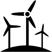
Renewables are predicted to overcome coal and become the fastest growing in the electricity sector sooner than we expect. With that said, the industry is seeking more efficiency and cost-effectiveness in its functions. Drones and a right operator can make the tasks of monitoring, mapping, planning and structural/default analysis at your energy site easy and effortless.
Whether its wind, solar, hydro, or tidal, our pilot network has some of the country's top professionals who have in-depth knowledge and can provide advanced drone surveys and inspection.
Request a quote today to see what we can provide for your business.

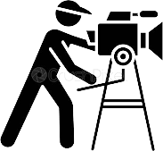
Aerial camera movement adds a sense of forward momentum, pace & energy, and allows the viewer to participate in the story. It elevates the footage and keeps the viewers immersed and engaged. If you wish to reach your audience with the best work, DroneWay will seamlessly provide aerial footage edited or non-edited versions. We work with your budget and goals, let us know today how we can help.
Do you need a wedding or other event filmed? Contact us today and we will provide that service with the best fit pilot we have for the job. Just let us know your preferences and ideas and we'll handle the rest.

Real Estate photographers usually have a drone or hire a drone pilot to shoot high-resolution marketing videos for the buyers. Due to the rise of residential real estate marketing on social media, almost 90% of listings these days include aerial photos and videos.
It is a highly competitive marketplace and aerial is necessary if you want to maximize success with your listings. At DroneWay, we work with real estate agents to make sure they get exactly what they want.
Simply give us details about your property and we will find you the right pilot and tailor everything to your style preferences.

Our specialized pilots can assist you in capturing high-resolution videos and images in the most difficult-to-access locations. For many industries, drones effortlessly target damaged structures and properties. Drones are necessary to facilitate a thorough inspection. An Inspection with a UAV device can help save insurance companies thousands of dollars and in many more industries. Whether it’s a small home or an entire solar windfarm, the camera vantage point is unmatched.
To request services for an in-depth inspection of damage or a regular survey, please send us your project details and we'll find you the perfect drone pilot.